
SemantiX Pert chart
A cross-sensor semantic EO data cube
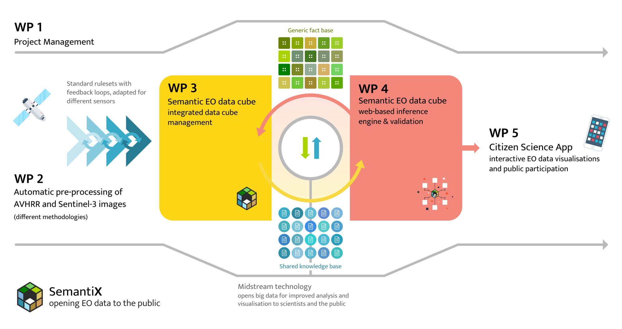
In the scope of this project, a prototypical cross-sensor semantic EO data cube, considered as a new EO-midstream technology, will be created using pre-processed AVHRR satellite data, Sentinel-3 A/B Copernicus data and derived analysis results. The cube will be linked to a smartphone application that will allow a demonstration of semantic queries of ECVs over a long time series (e.g., vegetation dynamics, snow cover over the last few years) as well as providing visualisation targeted to non-expert users. Anyone, whether domain experts, interested citizen scientists or the broader public, can query for changes in their immediate surroundings over time. Users of this app can contribute their own observations to extend the information available to everyone as well as help in validating semantic query results. The smartphone app will be a prototypical demonstration within an already established citizen science project, Nature’s Calendar (i.e., Naturkalender). This app already has an active user community and is actively being tested by students studying at academic partner institutions.
The project results from SemantiX contribute to continuing a unique data pool and expanding the portfolio of available EO-midstream technologies. For the first time, various target groups will have simplified access to these EO data and derived information, including ECVs. Scientists from disciplines unrelated to remote sensing, students (i.e., the next generation of scientists) as well as interested members of the public will have direct access to long EO data time series for a variety of applications without insurmountable technical hurdles. Access will be possible via the Web (i.e., in the browser) as well as using the mobile citizen science application. SemantiX will focus on the Austrian-Swiss alpine region, a European region that is currently experiencing serious changes due to climate change that will continue to create challenges well into the future.