Hello world!
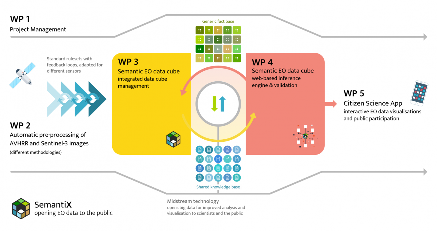
We are now approaching the halfway mark of the two-year project, and have laid enough of a foundation to finally begin sharing our progress with you all! The posts over the next year will walk you through the basis of the SemantiX project (concepts, data, technologies), our accomplishments and contributions to the scientific community, app users and interested public.
At the present moment we have established an initial semantic EO data cube based on Advanced Very-High-Resolution Radiometer (AVHRR) imagery and derived information and are in the process of making the connection to the citizen science appliation (see the connection between work packages 4 and 5 in the diagramm to the right). Expanding the semantic EO data cube with imagery and information derived from Sentinel-3 is in progress.
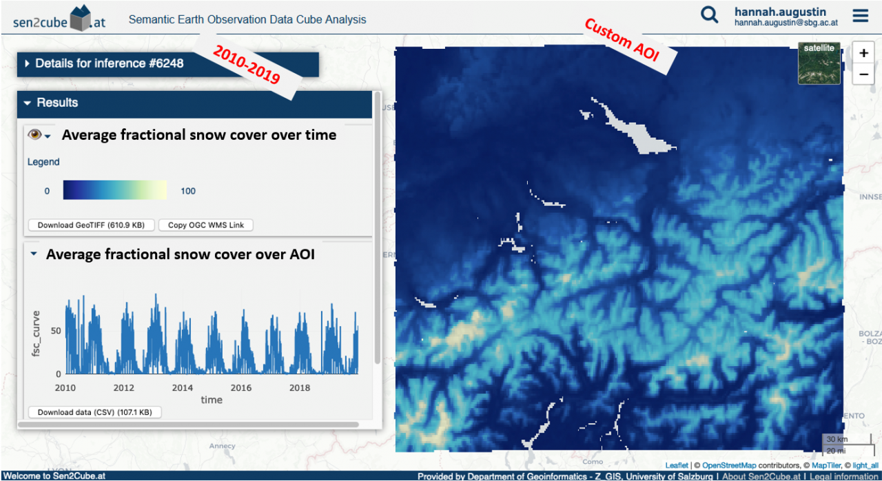
In the meantime, here is a sneakpeak of two results from a semantic query of fractional snow cover based on over ten years of AVHRR data from January 2010 through December 2019 for a custom area-of-interest (AOI) over the Alps. The time-series curve shows the average fractional snow coverage for every image available for the AOI (e.g. reduced over area), and the image of the average fractional snow coverage over the entire ten years (e.g. reduced over time). The AOI covers Liechtenstein, more than half of Switzerland, and parts of Austria, Germany and Italy. The large blob of "missing data" is Lake Constance. There are generally at least one or more observations per day from the AVHRR imagery that this information is generated from coming from multiple NOAA and MetOp satellites, and this multi-platform constellation of AVHRR sensors on NOAA and MetOp satellites allows for multiple observations throughout the day, which is very unique, compared to other similar data sources. The result has a spatial resolution of ca. 1km (i.e. 1km at nadir and a larger ground sampling distance further twoards the edges of an acquisition swath). The inference results are created, processed and displayed in the sen2cube.at graphical user interface developed by the EO Analytics research group at Z_GIS, University of Salzburg, and the AVHRR data and derived fractional snow coverage processing was conducted by the University of Bern's Remote Sensing Research Group.
About the author
By accepting you will be accessing a service provided by a third-party external to https://www.semantixcube.net/
This website uses no external trackers, no analytics, just session cookies and values your online privacy.